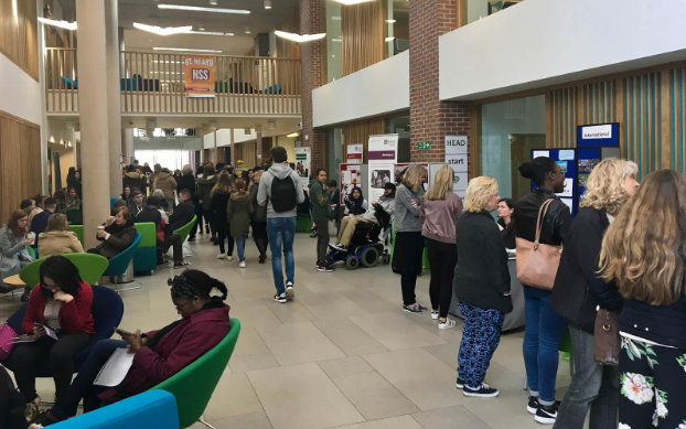
Book a demo
Let’s explore how Full Fabric can help you and your institution.
Let’s explore how Full Fabric can help you and your institution.

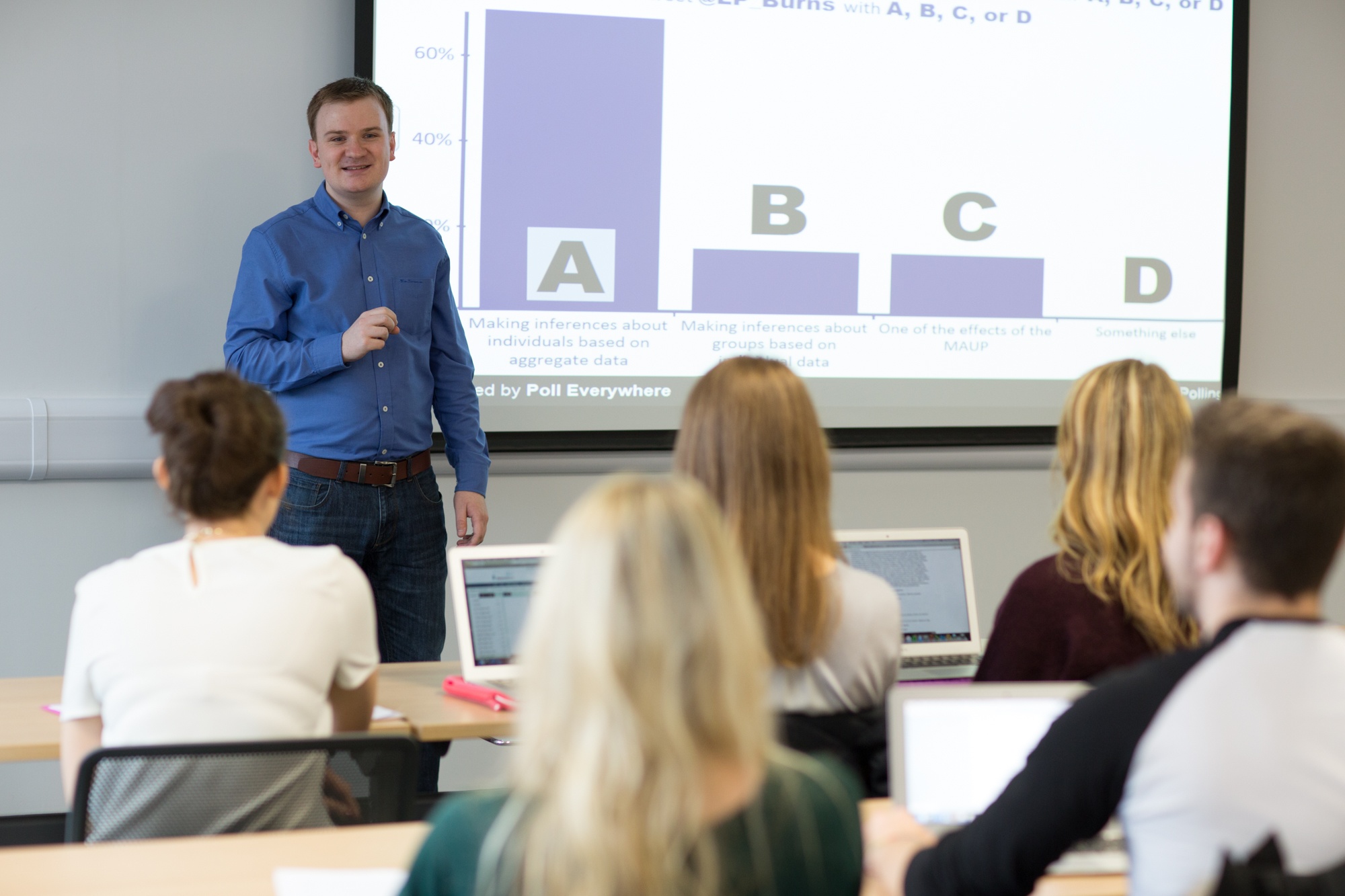
Dr Luke Burns is a Lecturer in Quantitative Human Geography in the School of Geography and Deputy Director (Education and Training) of the Leeds Institute for Data Analytics, University of Leeds. Having worked in both industry and academia, Luke has developed expertise in several areas of quantitative spatial analysis and mixes these with his passion for high quality student education and management.
Luke leads an innovative online Masters programme in GIS and teaches on a broad selection of analytical courses comprising undergraduate, taught postgraduate, open distance learning and continuing professional development. He also holds a visiting lectureship at the University of Strathclyde and has been recognised by the Association for Geographic Information and Times Higher Education for contributions to student education.
What does a working day in the life of Dr Luke Burns look like?
Most of my working days are highly varied with no set agenda per se. My days tend to be filled with teaching, teaching preparation, administration and more recently management duties. Needless to say, all days are very busy!
Whilst I have teaching and other duties that undoubtedly require fulfilment, being able to spend any remaining time exploring topics of most interest to me is something I particularly enjoy. This time tends to be spent on traditional and pedagogic research, some examples of which are discussed later on.
For those of us who aren’t in the know, what is a Geographical Information System (GIS)?
Without wanting to roll out the tried and tested definition, a GIS, simply put, is a way in which spatial data can be viewed and analysed. Spatial data is any dataset that has some form of locational component – think of a spreadsheet of customers with an address or a file containing all crimes in the past year with a XY coordinate. Taking this data and viewing it spatially on a map opens up many opportunities for more advanced decision-making, both in commercial and public sector environments.
Of course, a GIS can be a lot more than this with a sophisticated suite of analysis tools that can also be used to support decision-making but in essence it is about viewing data from a spatial perspective and then using this to make decisions.
As you can imagine, I get asked this question a lot and I tend to use this short animated video to help students understand what a GIS is all about.
What are the most rewarding parts of your job?
I am privileged to do a job that I enjoy so there any many rewarding aspects to this. As my role is very teaching-focused, there are three parts that particularly stand out.
Firstly, it is incredibly satisfying to see a student move through their education with continued improvement. Often students may struggle during their first year on an Undergraduate programme – this could be due to many reasons, not least being away from home for the first time, settling into a new environment, learning the academic culture etc. But quite often this doesn’t last long, and they progress to the point where they go on to achieve real success, potentially graduating with a first-class honours degree. Seeing this development in people is very rewarding, and even more so when you know that you have been a part of that.
Secondly, and very much linked to the first point, seeing a student graduate and go on to have success away from the university is very satisfying. Students learn a lot at university, not just in terms of academic skills but also life skills and seeing students go on to reach their potential is very rewarding. I have been fortunate enough to see students go onto some fantastic jobs, some of which I am slightly jealous of!
Lastly, when a student produces a piece of work that is of such high-standing that I work with them to publish this – reaching publication is something they are very proud of and hence rewarding for us all. I have achieved this with only a handful of students, but this is a very rewarding part of my role.
You’re leading an innovative online Masters Programme in GIS, launching in September 2019. Why did you decide to run the course online as opposed to on campus?
This is a very exciting time for GIS education. Whilst there are many GIS programmes taught across the world, very few offer complete online learning with such flexibility to fit around other commitments. We have a very successful face-to-face MSc GIS programme at Leeds and the idea behind this new online programme is to take this and enable as many people as possible to experience what we do.
"Whilst there are many GIS programmes taught across the world, very few offer complete online learning with such flexibility to fit around other commitments."
We hope to reach a wide e-audience! This isn’t new for us though, we have had a similar online programme before and this new programme represents a considerable refresh. We have already seen considerable interest in the programme and are looking forward to launching in late 2019.
Since the universal adoption of social media, big data has become a rich resource. How do you ensure people’s privacy is protected in the conclusions you draw from this data?
This is a popular question that is being asked more and more nowadays. I guess the simple answer is that we are careful and respect privacy but on the whole the data I use is not overly sensitive with regards to personal information. That said however, social media data, such as that scraped from websites like Twitter is public-facing so there is also responsibility on the individual to take care with what information they share.
As I concern myself with location analysis (using GIS and other tools), knowing where people tweet from is of use to me but with only around 5% of users enabling locational settings naturally this limits the data available.
You are also a member of Leeds Institute for Teaching Excellence. We’ve spoken a lot about blended learning with other higher ed professionals - what pedagogical practices are at the top of the agenda today?
There are lots and I continue to hear and read about practices that are new to me on a regular basis. This really is an area that is growing as people try to become more innovative in response to fee increases, student demands, inclusivity etc.
One I like is the flipped classroom approach. This isn’t something I have had the opportunity to trial yet but am very keen to do so. For those not familiar, this goes against common lecture principles and asks students to view content online before visiting the classroom and then this content is discussed, activities undertaken etc.
"With our innovative online MSc GIS launching soon I will certainly be exploring a range of blended learning approaches and trying to connect our face-to-face and distance learning students."
I have seen research that suggests this form of learning improves retention and understanding but having not trialled this I can’t comment further. I do know, however, that with our innovative online MSc GIS launching soon I will certainly be exploring a range of blended learning approaches and trying to connect our face-to-face and distance learning students. I am always open to suggestions!
How important is it to embed quantitative and data skills into university curricular - do you think it should be taught across all subjects to some extent?
This is hugely important and something I continue to stress time and time again. I wrote a blog about this not long ago which can be accessed here. And followed this up with a small piece of research available here, both through my involvement with the Leeds Institute for Teaching Excellence.
Without wanting to detract from the detail in the above work, my view is that data are changing and with this graduate recruitment is changing so it is imperative that universities meet this change head on and ensure curricula are up-to-date. It is the role of university courses (and not just more traditional technical courses) to equip students with the required skills to succeed in industry – that is the primary goal of any degree programme. Finding this balance between what industry wants (demand) and university course provision (supply) is very important and needs constant evaluation.
"It is the role of university courses (and not just more traditional technical courses) to equip students with the required skills to succeed in industry – that is the primary goal of any degree programme."
I have recently taken on a Deputy Director role in the Leeds Institute for Data Analytics and my remit concerns education and training. Ensuring students have the right skills for life after university is more important now than it has ever been. This doesn’t have to be through the more traditional three-year Undergraduate or one-year Masters degree though. Degree apprenticeships, placements, specialist modules and industry audits are all things to be considered and I am exploring these and more to try and ensure academia really does prepare students for the world of work.
How can businesses benefit from using geographical information science for strategic decision making?
Most of the big players in industry make use of GIS, many with an in-house team or specialist. And if not, they may have used consultancies to help with spatial decision-making. Retailers can use this to understand where existing customers live (or perhaps more importantly where customers don’t live so they can seek to grow market) perhaps then contrasting this with their store network (or rival networks) for optimisation purposes.
There are lots of more specific examples relating to certain industries but the principles are the same. Think about grocery stores collecting data when you swipe your loyalty card and then attributing this to your neighbourhood – the marketing possibilities are endless and GIS can be used to visualise and plan this very efficiently.
If any readers are interested, I always point them to this simple resource. This shows the range of industries that make use of GIS and some easy-to-follow examples: https://www.esri.com/en-us/industries/index
The impact of loneliness is garnering a lot of media attention at the moment and part of your research involves working with Age UK to define and develop a measure of loneliness.
What do you hope to achieve through this partnership?
This is actually something that first came about through a student project and ultimately led to a publication, similar to as mentioned previously. It was a very timely piece of work and has since led to a series of collaborations, including with Age UK.
Loneliness can be a very serious condition. Many people think it is simply a feeling with no wider implications but in reality, it is a lot more than that. Medical research has shown links to mental and physical health and with that it is easy to see why the government is so concerned – not least due to preserving quality of life but also costs that the national health and social care services incur.
The work sought to develop a means to measure loneliness (or risk of loneliness) in small-areas across the UK, trialled in London initially. The intention being that this could then be used by local authorities to direct resources to areas at greatest risk and prevent escalation or deterioration. The work has already seen considerable interest from within academic and outside. The work is summarised in an academic paper available here and is constantly evolving.
How do you foresee geographical information technology developing in 2019?
It is very hard to know, I always speculate on this in my final GIS lecture to undergraduate students each year – but really it is difficult to know for sure. I don’t think there is any doubt that we are now sitting on more data that ever before – there is a famous quote that states: “90% of the world's data has been created in the past two years” and when you actually stop to think about that it is pretty mind-numbing.
As all of this data has to be created ‘somewhere’ there will always be a need for somebody with geographical/locational skills and as such the technology will continue to evolve. I don’t know where we will be in ten or twenty years’ time but it seems pretty clear that GIS and other tools will need to be able to handle, process and work with Big Data far more efficiently than it currently does.
I certainly don’t think the need for or use of the technology will diminish, I just think things may change such that the tools meets the demands of the data.
My Job in Higher Ed is a monthly series. Take a look at our other interviews.
The development and maintenance of an in-house system is a complex and time-consuming task. Full Fabric lets you turn your full attention to maximizing growth and performance.